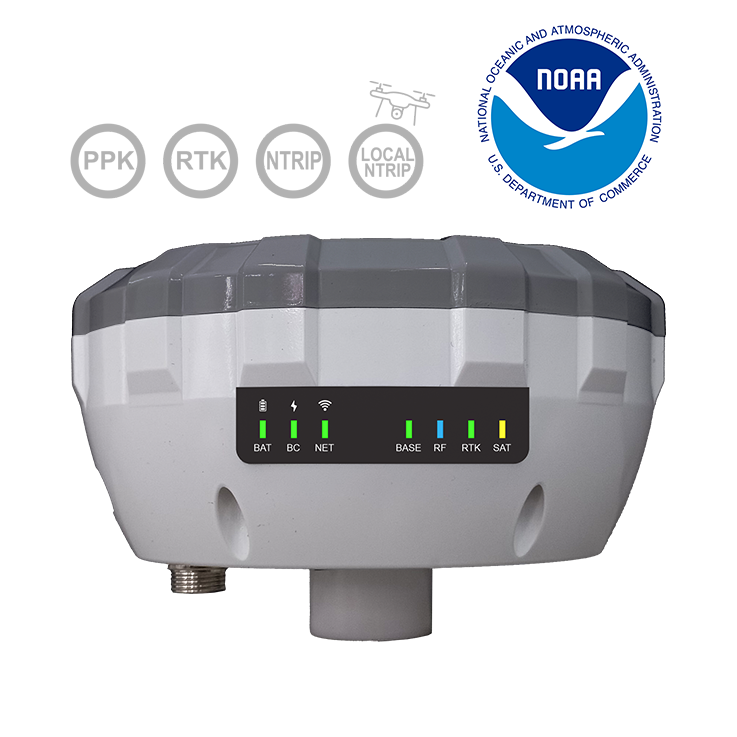
Calibrated by NGS (NOAA). Achieves millimeter-level accuracy in static mode. Configurable via Bluetooth and Wi-Fi. Features NTRIP LOCAL for sending corrections to RTK drones without an internet connection.
Performance, reliability, and cutting-edge technology in a single device
It automatically saves the data in UBX files.
32 GB internal memory
20 hours of operation in Data Logging mode and 10 hours in NTRIP mode
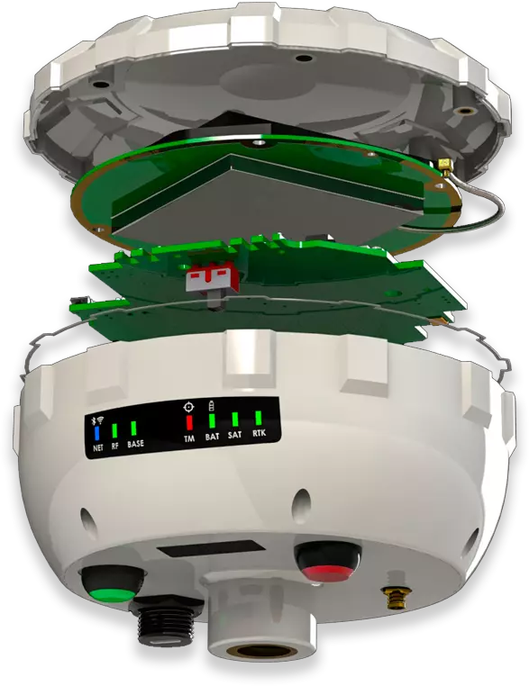
IP67 protection: Dustproof and waterproof
Multiband GNSS system with millimeter-level accuracy
Compatibility with multiple satellite systems: GPS/QZSS, GALILEO, GLONASS, and BEIDOU.
GNSS position fix in seconds, even in challenging conditions, with up to 10 mm accuracy.
With technology
Robust and compact design with IP67 rating
IP67 protection against water and dust.
Integrated multi-band GNSS antenna.
LoRa RTK radio with a range of over 10 km.
Centimeter-level accuracy up to 70 km (NTRIP) and 100 km (PPK).
10 Hz data logging frequency for continuous data recording.
Connectivity via Bluetooth, Wi-Fi hotspot, and USB serial port.
32 GB of internal memory.
Battery life of up to 20 hours in PPK mode and 10 hours in RTK mode.
Simple setup and seamless integration
Quick access via the X5R’s Wi-Fi hotspot.
Compatible with popular GIS software: SurPad, SW Maps, SurvPC, FieldGenius, SurveyMaster, and any application that uses NMEA data.
Local NTRIP solution for RTK drones
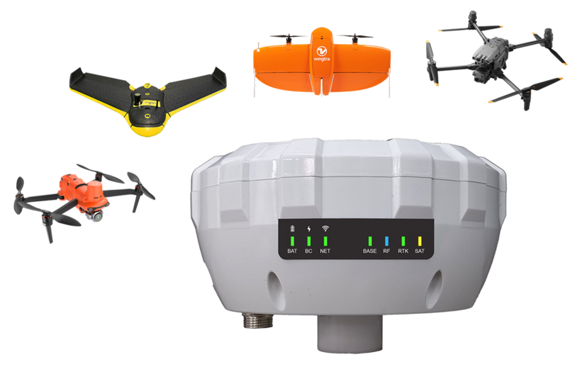
With NTRIP LOCAL mode, the X5R transmits GNSS corrections to RTK drones (such as DJI Enterprise, Wingtra, eBee, and Autel) without requiring an internet connection.
Users praise its simple setup and centimeter-level accuracy, even with DJI and Autel drones.
Compatible with Trimble SPA855, Emlid Reach, and other GNSS base stations*
Access the User Manual and Technical Data Sheet for the X5 device. Find detailed information to configure, use, and get the most out of all its features.
The professional app for smart surveying and layout. MettaGO is the mobile app designed for professionals who need efficiency, control, and centimeter-level accuracy in the field.
Learn how to configure and get the most out of the X5 GNSS Receiver.
Do you work in extreme conditions?
The X5R is your best choice.
Tell us about your needs, and one of our specialists will guide you in finding the best combination of equipment, accessories, and software tailored to your work.